
MOSAIC Explained What Your Flight School Can Actually Do Now by Right Rudder Marketing with DPE, Jason Blair

DPE and author Jason Blair breaks down what MOSAIC actually means for your flight school, not the hype version. He has been an examiner for nearly 20 years, was one of the first sport pilot examiners, and writes seven of ASA’s oral exam guides.

In this episode, the discussion covers:

  • The 59 knot clean stall speed rule and why your legacy 172s, Cherokees, Archers, and Warriors now qualify for sport pilot training in aircraft you already own. Jason explains why stall speed is judged as originally certificated, so a Horton STOL kit will not get you there, and why two Cessna 177 Cardinals of different model years can land on opposite sides of the line.
  • The sport pilot only CFI trap. A CFI-S can train toward solo and toward a sport pilot certificate, but cannot provide the 61.129 dual cross country time your commercial applicants need. If your instructor logged it, your examiner cannot count it. Jason walks through exactly where the line sits, including the flight review and tailwheel endorsement quirks that limit a pilot to sport pilot privileges afterward.
  • New endorsements and the medical catch. Night flying, retractable gear, and manual controllable pitch propellers each have their own endorsement now. A sport pilot flying at night still needs a medical. And a 16 year old with only a state ID cannot solo on a driver’s license.
  • Why the aircraft side is the real story. Manufacturers launched multi-engine and IFR approved MOSAIC compliant airplanes within days of Oshkosh. Jason talks price points in the $200,000 to $250,000 range against $600,000 to $700,000 legacy trainers, clean sheet three seat designs built for flight training, and one manufacturer targeting Amazon deliverable parts to cut your downtime.
  • Plus the check ride conversation every owner needs to hear. Check rides went from about 67,000 a year in 2012 to 156,000 last year. Roughly 30 to 35 percent get sent back for broken airplanes, short cross countries, and missing endorsements. Jason explains how prepared schools get preferential scheduling, and gives his number one piece of advice for applicants.

Listen in here:

The Vanishing ADF Approach: What Most New Instrument Pilots Will Never Fly

For decades, the non-directional beacon (NDB) approach flown with an automatic direction finder (ADF) was a staple of instrument flying. Today it is nearly extinct. Most pilots training for an instrument rating will never fly one in an actual airplane. The FAA even managed to finally remove questions about NDBs and ADFs from the knowledge tests a few years ago.

But some of us remember. I admit I am old enough to remember doing these in my instrument rating and CFI-I training, and not just a few of them in actual IFR to get home to an airport.

Particularly, the home airport I learned to fly at had an NDB approach that used an ADF. Specifically, it was the NDB runway 29 at Oconto, WI (KOCQ) on a frequency of 388. That is still burned into my mind.

Eventually, the plate for it got updated to the one I found an old copy of here, the NDB (wait for it…) or GPS Rwy 29. It was in a period of time when new navigation systems were taking over and kicking out, even on the same chart. This plate has long disappeared, replaced with a modern RNAV GPS RWY 29 that is much easier to fly. But I still think I could fly the old NDB that my first instructor drilled into me if it was ever there again. Probably by memory if I had to.

This particular historical approach plate captures a classic late-era example of an NDB approach that utilized an ADF.

The OCQ NDB was on 388 kHz and sat on the field and served as both the initial approach fix and the missed-approach holding fix. Final approach course was 301°, there was no depicted final approach fix, and the MDA was 1,240 feet (636 feet height above touchdown). The missed approach required a climbing left turn to 2,300 feet via a 180° heading, then a left turn direct to the NDB. Notes called for the Green Bay altimeter setting and pilot-controlled lighting. Straight-in and circling minima were published, with Category D not authorized. The chart title itself—“NDB or GPS”—marked it as a product of the transitional years when GPS was being grafted onto the existing NDB infrastructure.

On an approach such as this one, pilots were lucky. The NDB was on the field and you could more easily “home” to the location. You would fly to the station, get station passage, then fly the outbound leg, conduct a procedure turn, then fly back inbound. If you passed the station again and hadn’t broken out, it was time to go missed. In cases where the NDB was based off the field, the pilot might cross a station and then proceed inbound, following a bearing, and using timing to identify a missed approach point. Those were less fun, and less accurate. I don’t miss them.

NDB/ADF procedures were a genuine improvement over the four-course “A-N” radio ranges that dominated the 1930s and 1940s. Those earlier ranges forced pilots to fly by ear, listening for the steady on-course tone created by overlapping Morse A and N signals while managing quadrant ambiguity. The NDB used a simple single-antenna transmitter and an airborne ADF whose needle pointed continuously toward the station. Pilots could track to or from the beacon, fly procedure turns or holding patterns, and conduct an approach with far less aural workload. For many years this combination delivered practical instrument access to smaller airports that lacked VOR or localizer service.

The limitations remained significant. Low- and medium-frequency signals suffered from thunderstorm static, night effect, coastal refraction, and terrain reflection. The ADF needle could swing or reverse. Without collocated DME there was no direct distance information. Continuous wind correction and relative-bearing arithmetic were required, and minima were typically higher than those later available with GPS. Despite these shortcomings, NDB approaches remained operationally useful well into the GPS era because the beacons were inexpensive to install and maintain, especially at general-aviation fields, and because they offered a simple backup.

A key transitional phase occurred in the 1990s and early 2000s. As IFR-certified GPS receivers proliferated, the FAA launched the GPS Overlay Program. Existing NDB (and VOR) approaches were amended by adding “or GPS” to the title. This allowed pilots to fly the same tracks, altitudes, and procedural elements using GPS as the primary navigation source, without needing a working ADF or even monitoring the NDB signal in many cases. The Oconto plate is a textbook illustration of that era. These overlays accelerated the acceptance of satellite navigation, reduced dependence on aging ground equipment, and gave operators a graceful path away from analog ADFs that were already disappearing from panel space. Over time most of the overlays themselves were replaced by standalone RNAV (GPS) procedures that no longer referenced the NDB at all.

The Oconto NDB or GPS Rwy 29 followed that path. Today the airport is served only by RNAV (GPS) approaches to Runways 11 and 29. Across the National Airspace System not many pure NDB or NDB/DME approach charts remain, and they are going away quickly. The NDB itself is no longer required for the instrument rating practical test, and the majority of training aircraft no longer carry functional ADFs.

The ADF approach was never elegant, but for a long stretch of aviation history it was essential. The “NDB or GPS” plates of the early 2000s represent the brief middle chapter in which the old technology was allowed to share the stage with the new. That chapter has closed. New instrument pilots will encounter the concept in textbooks and simulators; very few will ever chase a real needle toward a real NDB on a published procedure.

It has been a while since I have had to use an actual NDB approach. In fact, the most common use I had for ADF devices, before the advent of bluetooth headsets and the ability to play music to my own headphones from my phone, was tuning into 720 AM and listening to Cubs games. I know lots of fellow pilots that most frequently in the last days of ADFs used them to listen to various AM radio stations in their area of operations.

Never flown an NDB approach? Or even seen an ADF in an aircraft (that works)? Check out the simulator below here to play with how it might look  as you move the aircraft was moved around near it and your compass heading was changed.

Click here to show this NDB/ADF simulation in its own page as a standalone.

On the Beam: How Pilots Once Steered by Sound Using A-N Ranges —and Why We Don’t Anymore

Before VORs, GPS, and glass panels, pilots navigated by listening. The low-frequency four-course radio range—commonly called the A-N range—was the backbone of instrument navigation in the United States from the late 1920s through the early 1950s. It was crude by today’s standards, yet remarkably effective at getting airplanes where they needed to go.

Each station transmitted two interlocking figure-eight patterns. One radiated the Morse code letter “A” (dot-dash); the other radiated “N” (dash-dot). Where the patterns overlapped, the signals merged into a continuous 1,020-hertz tone. That narrow equisignal zone—typically three to four degrees wide—defined the course, or “beam.” Off the beam, the pilot heard a clear A or N, telling him which way to turn to regain the steady tone. Station identification interrupted the signals twice a minute so the pilot could confirm he was listening to the correct range.

Pilots “flew the beam” by keeping that monotone in their headphones for hours. Approaching the station, the signal grew louder until the aircraft entered the cone of silence directly overhead, then the opposite beam appeared as they continued outbound. Complex orientation procedures existed for pilots who became lost in an A or N quadrant: a series of timed turns and signal-strength comparisons to identify which of the four legs they had intercepted and which way led to the station.

The system had serious limitations. Low-frequency signals suffered from static, especially during thunderstorms when guidance was likely needed most. Nighttime skywave interference and terrain reflections could bend or create false courses. Ambiguity was constant—pilots often knew they were on a beam but not which of the four. Continuous headphone listening was fatiguing, and the equipment offered no distance information beyond the cone of silence. Yet for all its shortcomings, the A-N range worked. Airways were built around the beams. Airmail and early airline schedules became reliable. Instrument approaches to moderate ceilings were flown using the same aural cues. Generations of pilots developed a practiced ear that could hold a course within a couple of miles at 100 miles from the station.

We are fortunate those days are behind us. Today, a pilot can load a direct-to, watch a moving map, and cross-check GPS against VOR or ILS with a glance. Precision, redundancy, and situational awareness are orders of magnitude better. Still, the A-N range deserves respect. It proved that disciplined listening and clear procedures could keep airplanes safe when the weather closed in. Modern tools make the job easier and safer, but they rest on foundations laid by pilots who once steered by the simple difference between a dash-dot and a continuous tone.

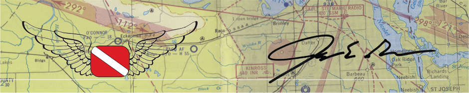
You can even see in this chart from 1963 around the Grand Rapids, MI area that courses were still on the charts back then!

Most of the pilots flying nowadays have never seen, or especially heard, an actual A-N range. And that got me curious, so I put together a little sample demonstrator program that you can play with to see what it might have sounded like for all of us fortunate enough to never have to navigate using them.

Check it out and be thankful for our modern tools. Heck, I would take an ADF over this every day! Oh, and yeah, a GPS too.

Be sure to drag the little airplane around the map to hear the different sounds you would get based on where you were in relation to the beam.

Click here to show this A-N Range simulation in its own page as a standalone.

CFI Duty Time Calculator: Stay Compliant with the Under 8-Hour in 24-Hours Regulation

Busy CFIs can sometimes have to do some careful math to stay under the FAA’s regulation regarding dual-flight instruction given in a 24-hour period regulation (14 CFR § 61.195 (a)).

Under the restrictions of this regulation, a CFI may not provide more than eight hours of flight training in any consecutive 24-hour period. This is a rolling window, not a calendar day. Ground instruction does not count; only flight training time does. Exceed the limit and you are in violation, regardless of how carefully you planned the day.

The practical challenge is real. A late-afternoon dual session yesterday, maybe a night flight, then an early morning lesson today can push you over eight hours without either day looking excessive on its own. Busy instructors juggling multiple students, weather delays, and checkride prep often lose track of the exact total. Manual tracking with a paper log or spreadsheet works until the schedule gets messy. That is where a simple, dedicated tool helps.

I created a free CFI Duty Time Calculator for exactly this purpose. It lets you enter the start and end times (or duration) of recent and planned flight training sessions (yesterday, today, and tomorrow for example) and calculates your total flight training time inside the current 24-hour window. You can see how many hours remain available before you hit the regulatory limit and whether a proposed additional lesson would put you over. Or if your planned flights for tomorrow based on what you will fly tomorrow will put you over the rolling hours total.

How to use it:

Enter the actual start and stop times for your flights in the relevant training periods that fall inside the rolling 24 hours looking backward from now (or from the end of a planned future session). Then Input the times of completed dual flights and any upcoming lessons you intend to give.

The calculator totals the flight training time and displays the result against the eight-hour ceiling. If you are approaching or exceeding the limit, you see when this will happen and can adjust, move, or reschedule a lesson. You might even have another instructor pick up a flight or you, or delay your flights to build in the required rest.

Instructors who regularly work long days or teach across multiple locations benefit the most. The calculator does not replace professional judgment or official logbook entries, but it gives a fast, reliable way to cross-check your planned or already done flight training events as a CFI before you accept one more lesson.

The tool takes only a minute or two and removes the mental arithmetic and the risk of an honest mistake.

Bookmark the page, use it whenever the schedule looks tight, and keep your flight training hours cleanly under the eight-hour mark.

Click here for a stand-a-lone page that is the calculator.